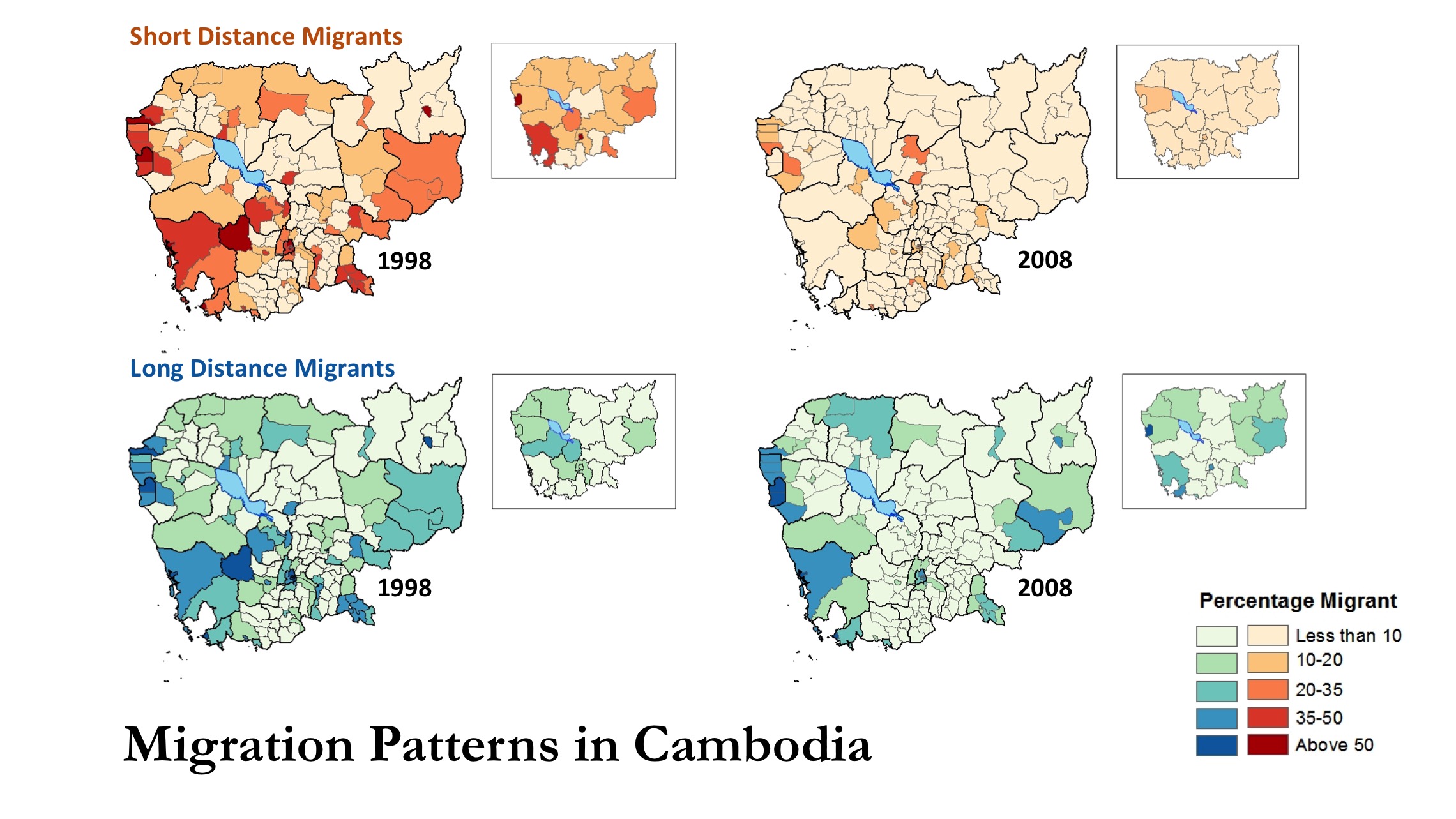
NHGIS recently launched a pair of web maps highlighting the available GIS files and striking changes in boundaries over time for two popular geographic levels. The ‘Census Tract’ map displays data for years 1910 to 2014, and the ‘Place’ map depicts data for 1980 to 2014. With each year listed as a separate layer, users can easily toggle specific years on and off to visualize the data.
Data Projects
Counting—and Redefining—the Cost of War
Associate Professor of History and MPC Faculty Member J. David Hacker made headlines in 2011 when he published a groundbreaking study of the total number of U.S. Civil War dead. Hacker argued that the widely-accepted figure of 620,000 was far too low. Using IPUMS, Hacker showed that the number of dead was at least 750,000—if not more. His article, “A Census-Based Count of the Civil War,” published in Civil War History, was introduced by the editors in the issue as “among the most consequential pieces ever to appear in this journal’s pages.”
Few demographic historians expect attention from mainstream press when they publish their research, but Hacker’s study attracted national interest, including interviews with the New York Times and National Public Radio.
MPC launches IPUMS Higher Ed, new data tool for researching education attainment
The Minnesota Population Center has released a new data project: IPUMS Higher Ed. IPUMS Higher Ed is composed of three National Science Foundation surveys of college degree holders in the United States: the National Survey of College Graduates, the Survey of Doctorate Recipients, and the National Survey of Recent College Graduates. Only the respondents who have a degree in science or engineering (or related fields) or work in a science or engineering occupation are included in the SESTAT file for that year. The first version of IPUMS Higher Ed website will provide integrated SESTAT and SDR files from 1993 to 2013.