The TerraPop team is excited to announce the launch of a new, completely redesigned user interface. TerraPop enables research, learning, and policy analysis by providing integrated spatio-temporal data describing people and their environment. The new interface is more intuitive and easier to use. Choosing data and creating an extract are structured as a step-by-step process. You are guided through the workflow, seeing the information you need to make selections at each step. Throughout the process, you have access to complete metadata describing available variables, datasets, and geographic levels. Give the new extract builder a try.
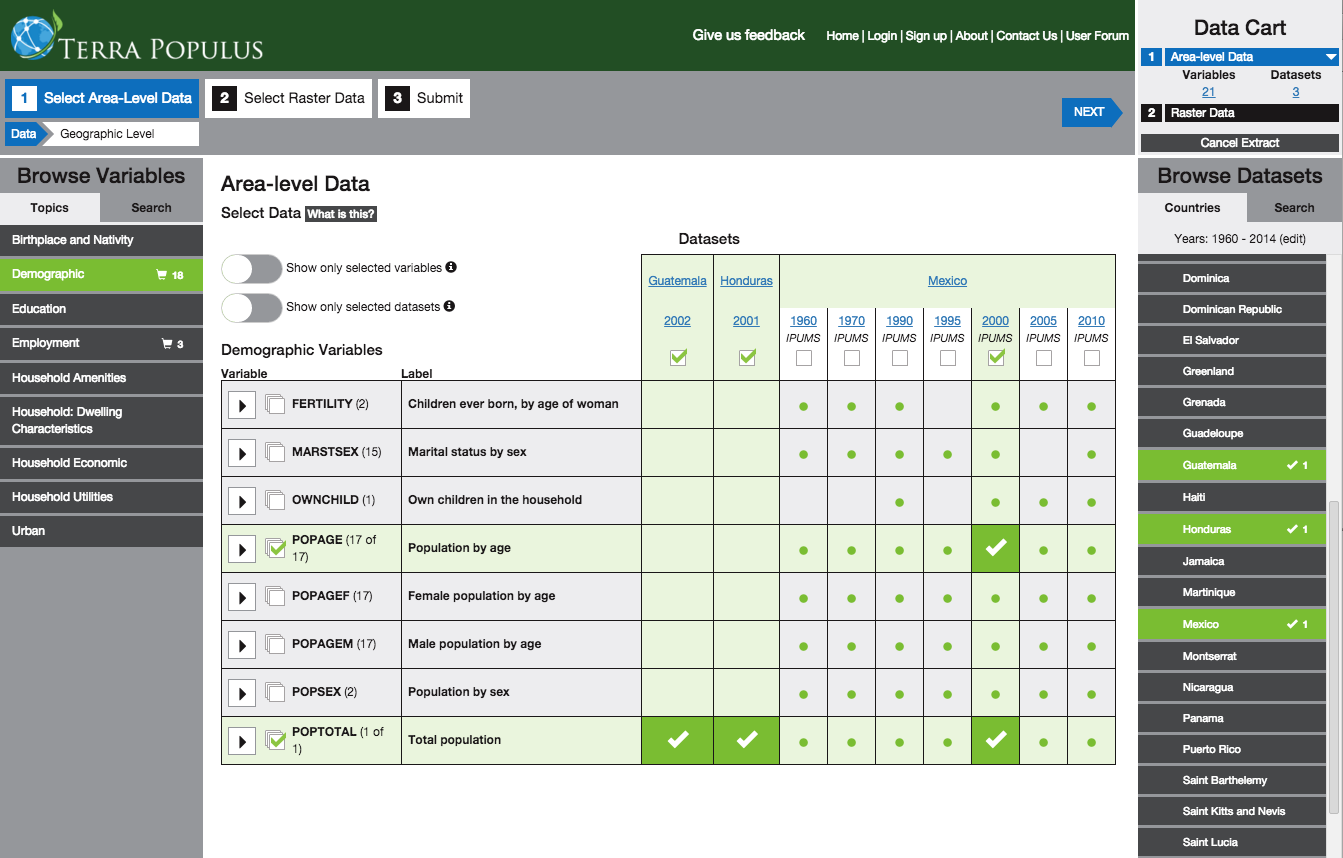
One particularly helpful feature is integrated selection of variables and datasets, which are now performed on the same screen. This integration allows you to easily see which variables are available in which datasets and make your selections accordingly. In the screenshot below, the user has selected datasets for Guatemala 2002, Honduras 2001, and Mexico 2000, and variables for total population and population by age. The population by age variables are only available for Mexico, but Guatemala and Honduras currently have only total population data.

The new interface allows you to create area-level extracts, consisting of records describing geographic units, such as U.S. states. The data can be linked to geographic boundary files, which you can include in your extract. Area-level extracts can include population data from any of 159 countries, with variables related to demographics, education, employment, and household characteristics. They can also include land cover and climate data summarized from rasters, such as the percent forest cover or mean annual temperature for each geographic unit.
For land cover and climate raster data, another option is TerraClip, a tool that allows you to get a raster for your country of interest for any of the raster datasets in the TerraPop collection. Over the next few months, we will add the ability to create raster extracts (which may also incorporate area-level data) and microdata extracts with the ability to attach variables derived from area-level and raster data. For now, you can access these types of extracts in “TerraPop classic,” our old interface. Join our mailing list to receive email updates on this and other news about TerraPop.
