
The IPUMS spatial team is excited to introduce two new products that expand the ways you can access NHGIS data. IPUMS GeoMarker enables you to easily attach contextual characteristics from ACS data to address or point data, and the first public IPUMS API provides programmatic access to NHGIS data and metadata. Both products officially moved out of beta in December 2019.
IPUMS NHGIS
Posts related to IPUMS NHGIS
Homeownership and Race in the Twin Cities: Applying IPUMS NHGIS Geographically Standardized Time Series Data
Geographically standardized time series tables from IPUMS NHGIS give users powerful new abilities to analyze census tables and geographic data across time.
NHGIS time series tables link together comparable statistics from multiple U.S. censuses. Geographic standardization refers to harmonizing data from separate censuses to align with a consistent set of geographic boundaries. At this time, NHGIS provides 1990, 2000, and 2010 data harmonized to 2010 census units. Subsequent releases of American Community Survey (ACS) summary data also generally use 2010 census units, making it possible to link NHGIS time series directly to ACS data for any year since 2010.
In this post, we apply this innovative NHGIS data product to explore homeownership rates in the Twin Cities (Minneapolis–Saint Paul, Minnesota), comparing rates of homeownership between black and white householders for 1990, 2000, 2010 and 2013-2017 ACS 5-Year Estimates.
New Features in NHGIS Help Visualize Available Data
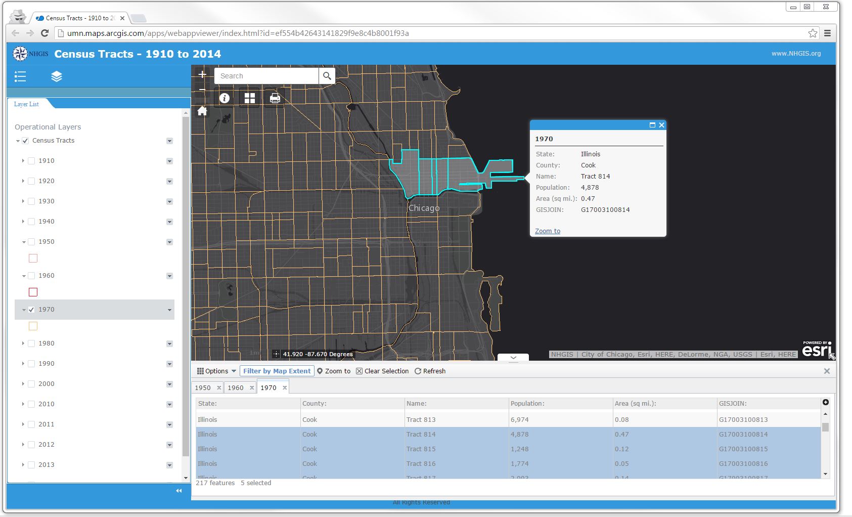
NHGIS recently launched a pair of web maps highlighting the available GIS files and striking changes in boundaries over time for two popular geographic levels. The ‘Census Tract’ map displays data for years 1910 to 2014, and the ‘Place’ map depicts data for 1980 to 2014. With each year listed as a separate layer, users can easily toggle specific years on and off to visualize the data.