Mapping Block-Level Segregation: The Twin Cities’ Black Population, 1980-2010

Research, data preparation, story and graphics by Amalea Jubara and Yaxuan Zhang (Minnesota Population Center, Summer Diversity Fellows), mentored by Jonathan Schroeder (IPUMS Research Scientist) and Ying Song (Assistant Professor, Department of Geography, Environment & Society)

Edited by Jonathan Schroeder (IPUMS Research Scientist)

IPUMS NHGIS Block Data: An Expanding Collection

The most spatially precise U.S. census data are block-level tables, summarizing population and housing characteristics for millions of blocks throughout the country. IPUMS NHGIS provides block-level tables for the 1970 to 2010 decennial censuses as well as block boundary files for 1990, 2000 and 2010. This collection is set to grow substantially in the next few years as NHGIS adds new 2020 census block data and as we continue with a major initiative to construct 1980 and 1970 block boundary files. This expansion will open up new possibilities for high-precision spatial analysis across a longer time span.

A Case Study of the Twin Cities’ Black Population

To demonstrate some of the potential value of this expanding collection, we use NHGIS block data, including some not-yet-released 1980 block boundaries, to explore the recent history of racial segregation and integration in the Black population of the Twin Cities of Minneapolis and St. Paul, Minnesota, from 1980 to 2010. We present the block data in an interactive map along with data on early-20th-century racial covenants and the “redlining” zones of the Home Owners’ Loan Corporation (HOLC), recently published by the Mapping Prejudice and Mapping Inequality projects.

The block-level changes since 1980 show a striking trend toward greater dispersion and integration of Black residents, but segregation persists; several neighborhoods still have uniformly low or high proportions of Black residents. By overlaying racial covenants and HOLC zones with the block data, we can also find cases where the historical discriminatory practices appear to have left a lasting imprint on the distribution of Black residents.

Continue reading…

1930/31 Time Diary Data from College Educated Women in the United States

IPUMS Time Use, in partnership with Dr. Teresa Harms of the Centre for Time Use Research, is proud to announce the public release of the 1930-31 USDA College Women Time Use study. These data provide researchers a unique look into the lives of married, college-educated women at the beginning of the Great Depression. The respondents were asked to complete a detailed record of their time use for seven consecutive 24-hour periods (see a sample daily diary below; borrowed with permission from Teresa Harms, CTUR). The women described activities in their own words, listing them consecutively as they occurred throughout the day, with a minimum interval of five minutes. They also recorded the time devoted to various homemaking tasks by other household members and paid help as well as demographic and work status data and information about the household. The data also include the verbatim activity reports and the occupations the women reported at the time of data collection. All data are available via the IPUMS American Heritage Time Use Study (AHTUS) extract system.

Continue reading…

2021 IPUMSI New Data Release Highlights

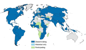
Map depicting where IPUMSI has dataIPUMS International has added 19 new census samples and new labor force surveys.  First-time data release countries include four new countries from four different continents—Finland, Mauritius, Myanmar, and Suriname. Other newly added samples extend pre-existing series. Another first is the addition of labor force surveys from Spain and Italy. See a summary of the full IPUMS collection on the IPUMSI samples page.

In addition to the new data, check out the usage-enhancing highlights that are part of this recent release.

  • Spatially-harmonized migration variables
  • New work variables that maximize the utility of newly-harmonized labor force surveys
  • New disability variables per The Washington Group recommendations
  • Access to harmonization tables and code for registered IPUMS data users
  • Population density variables for all samples with the requisite geography- POPDENSGEO1 and POPDENSGEO2 capture the population density in persons per square kilometer of the first and second administrative units of the household, respectively.
  • Variables AREAMOLLWGEO1 and AREAMOLLWGEO2 provided for additional convenience
  • New lower level single-sample variables for select countries, as well as regionalized variables and shapefiles at the 3rd administrative level for Senegal 2013 and 2002, South Africa 2016, 2011, and 2007, and Uganda 2014, and Myanmar 2014

Continue reading…

Locating Dimensions of Women’s Empowerment in Family Planning in Burkina Faso

By Tayler Nelson

Women’s “empowerment,” defined by Naila Kabeer[1] as “the expansion of people’s ability to make strategic life choices in a context where this ability was previously denied to them,” has been shown[2] to be associated with greater birth spacing, lower fertility, and lower rates of unplanned pregnancy. Yet scholars disagree[3] on how to measure women’s empowerment, and meanings of empowerment can shift across geographic and cultural contexts.

IPUMS PMA’s family planning surveys include variables that can help researchers investigate dimensions of women’s empowerment in family planning. All samples include indicators of women’s knowledge about family planning methods. Many survey rounds dig deeper, collecting data that can be used by researchers and policymakers.

The Burkina Faso 2018 Round 6 survey includes a range of variables measuring family planning attitudes, beliefs, and decision-making dynamics that relate to women’s empowerment. I used a weighted polychoric factor analysis[4] to investigate women’s empowerment in family planning in Burkina Faso. Factor analysis can help researchers reduce a large number of observed variables by identifying similar response patterns among observed variables and grouping them into a smaller set of underlying variables, or factors. Through analyzing how variables are grouped and the strength and signs of coefficients within these groups, researchers can glean insight into which sets of observed variables might be best at measuring an unobserved construct such as women’s empowerment.

Continue reading…

IPUMS IHGIS: Unlocking International Population and Agricultural Census Data

By Tracy Kugler

Nearly all countries throughout the world conduct population and housing censuses at least every ten years, and most also conduct agricultural censuses or surveys regularly. These censuses collect information on demographics, education, employment, housing characteristics, migration, agricultural land ownership, agricultural workforce, livestock, crops, and more. The resulting data can be used to study a wide range of questions, from the character of demographic transitions within and across countries, to utilization of irrigation, to educational trends among women. 

Unfortunately, this wealth of data has remained largely inaccessible to researchers. The data are typically published in reports as tables summarizing population characteristics. In recent decades, many of these reports have been published as PDF documents and made available on national statistical office websites. While the reports are available, data from a PDF document cannot be easily imported into a statistical or GIS package. Furthermore, the table structures are highly heterogeneous, both across countries and even within the same report.

The International Historical Geographic Information System (IPUMS IHGIS) is designed to provide easy access to these data in a way that researchers can easily use for analysis. In the early phases, IHGIS was known internally as “Project Mako,” named after the Mako shark, which has a global range, voracious appetite, and a reputation for a broad-ranging diet. Like the shark, IHGIS (née Project Mako) will encompass the world and ingest all kinds of data tables.

Continue reading…

What’s new with IPUMS USA? Updates for Industry and Occupation Variables

By Megan Schouweiler (Senior Data Analyst, IPUMS USA) and Sophia Foster (Data Analyst, IPUMS USA)

The Census Bureau drops ACS 1-year PUMS files tomorrow (October 15, 2020)! Don’t worry, the IPUMS USA team will get right to work to get you some data as soon as possible. In the meantime, let’s talk a little about what’s new with occupation and industry variables on IPUMS USA.

New OCCSOC and INDNAICS Crosswalks Available

You may be familiar with our harmonized occupation (OCC1950, OCC1990, OCC2010) and industry variables (IND1950, IND1990). These variables harmonize occupation/industry codes based on Census Bureau classification systems to a base year, making comparisons across time much easier. Researchers are also interested in using the Standard Occupational Classification (SOC) system and North American Industry Classification System (NAICS) codes that are available in the public use data; IPUMS has not created nifty harmonized variables for these codes. We hope to harmonize these codes someday– until then, we will settle for providing great documentation about how these codes have changed over time. And we’ve recently made the documentation even better!

OCCSOC reports the primary occupation based on the SOC system, and INDNAICS reports the type of establishment of the primary occupation based on the NAICS system. Both of these coding systems are periodically updated. In the past two decades, the OCCSOC codes have been updated six times and the INDNAICS codes have been updated five times, creating a challenge for those utilizing the codes to conduct research across time. Beyond navigating the changes to the coding schemes, there are separate crosswalks for each update. We recently updated each of our crosswalks to include all iterations of the underlying coding systems from 2000 onward in a single table for OCCSOC and INDNAICS, respectively. Instead of a bunch of links to crosswalks that just compare adjacent schemes, we’ve combined all years into one table.

In total, we created four crosswalks: OCC to OCCSOC; IND to INDNAICS; OCCSOC only; and INDNAICS only. These crosswalks include detailed descriptions of how OCCSOC and INDNAICS codes have changed over time from the 2000 Census to present. Examples of changes include one occupation/industry splitting into multiple new categories, multiple categories collapsing into one occupation/industry, and updates to codes and titles. Because these types of changes occur with each new iteration of the coding scheme, it can be difficult to understand how the codes relate to one another across time. We hope that these new crosswalks provide a more comprehensive mapping of the OCCSOC and INDNAICS codes over time and will aid researchers in using these variables. These crosswalks are available to view on the IPUMS USA website and for download in both Excel and CSV format. Trust us, you’ll want to download these crosswalks to make your programming a lot easier.

Continue reading…

IPUMS provides demographic data for international COVID-19 research

By Lara Cleveland

Since the onset of the COVID-19 outbreak, researchers across the globe have been accessing census microdata from IPUMS International for COVID-19-related research. Scholars at universities from the U.S. to Nepal, Columbia to Belgium, Nigeria to China, and elsewhere have used IPUMS data to assess population dynamics contributing to COVID-19 vulnerability or spread. Divisions of the United Nations, World Bank, and other policy research institutes have similarly accessed IPUMS census data for COVID response and relief efforts.

IPUMS International harmonizes and disseminates household-level microdata census samples from more than 100 countries. Access to microdata is essential for rapid response in new areas because of its analytic flexibility. Researchers needing to build custom tables or construct variables for complex modeling suited to specific research questions can only do that with microdata. Of particular interest for research on population dynamics of COVID-19 is information about the age structure of the population, household living arrangements (household size, intergenerational co-residence, etc.), indicators of health vulnerability (age, work status, housing conditions, disability, etc.), healthcare workforce distribution, and migration patterns. IPUMS International census samples also include valuable subnational geographic identifiers at the first and second administrative levels, which are especially useful for highlighting particular regions or localities of vulnerability.

Continue reading…